As the port authority responsible for Canada’s largest port, it is our job to carefully balance multiple priorities and interests across our jurisdiction. Part of this responsibility means managing—on behalf of all Canadians and in support of national trade—the federal lands and waters that make up the Port of Vancouver.
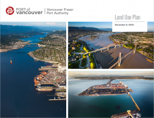
Similar to a municipality’s official community plan, our Land Use Plan guides the long-term development and use of port lands and waters over the next 15 to 20 years.
The purpose of our land use plan is to:
- Communicate the direction of our long-term land use policy directions
- Guide land use and future growth opportunities
- Help current and future port tenants and customers identify areas in which to invest in new or intensified operations
- Facilitate coordination of land use and transportation planning with neighbouring communities and government agencies
- Provide neighbouring residents and communities with greater clarity about activities and uses that may occur on port lands and waters, and how community interests will be considered
- Provide clarity to Indigenous groups about activities and uses that may occur on port lands and waters adjacent to reserves and within asserted traditional territories, and how Indigenous interests will be considered
As trade growth continues, we acquire land to support future port-related activities. We focus on sites with easy access to shipping channels, truck routes, or rail corridors, and close proximity to existing port holdings. Making strategic land acquisitions is one of the ways we ensure the Port of Vancouver is ready to handle growing trade.
Under the Canada Marine Act, the Vancouver Fraser Port Authority must amend the land use plan to remove any divested land and add newly-acquired sites, and we must outline the intended use of new land through a formal notice. The plan was most recently updated and adopted by the port authority’s board of directors in December 2020.
The Vancouver Fraser Port Authority makes annual amendments to our land use plan. This process includes a 60-day public consultation period. Once the amendments are adopted by the port authority’s board of directors, a notice of decision is posted and advertised across the region.
2020 Land use plan amendment
On October 27, 2020, the Vancouver Fraser Port Authority board of directors adopted an amendment to the land use plan that incorporated two property acquisitions; one in North Vancouver and one in Surrey. The amendment also designated the intended use of a previously undesignated port authority site in Delta, and re-designated the use of a portion of an existing port authority site in Delta. Public consultation on this year’s amendment took place from June 1 to August 1, 2020. Details of the amended properties are available in the notice of decision as well as the consultation summary report.
Past amendments
2020 consultation summary report and notice of decision
2019 consultation summary report and notice of decision
2018 consultation summary report and notice of decision
2017 consultation summary report and notice of decision
The land use plan is organized into seven planning areas based on geography and port-related activities. A comprehensive interactive land use map, along with individual planning area maps have been included to highlight the port authority’s current jurisdiction in the Lower Mainland.
Planning Area 1 – Burrard Inlet South Shore [PDF]
Planning Area 2 – Burrard Inlet North Shore [PDF]
Planning Area 3 – Indian Arm [PDF]
Planning Area 4 – Fraser River Inland Reaches [PDF]
Planning Area 5 – Fraser River Central [PDF]
Planning Area 6 – Roberts Bank [PDF]
Planning Area 7 – Fraser River North and South Arms [PDF]
In December 2020 the port authority’s land use plan was updated to reflect current and future market trends critical to Canada’s growing trade, supports local communities and Indigenous groups, and generates benefits for all Canadians.
A two-phased engagement process was facilitated from fall 2019 to summer 2020. We engaged local governments, Indigenous groups, the public, and stakeholders to help update our land use plan.
The Phase one and Phase two engagement summary reports and the consideration report outline the full engagement process and demonstrate how input was considered when updating the land use plan.
The port authority’s original land use plan was issued in 2014. It was developed in consultation with more than 1,000 people representing municipalities, Indigenous groups, government agencies, environmental organizations, business and industry stakeholders, and the public.
Resources:
Land use plan
Phase 1 engagement summary report
Phase 2 engagement summary report
Consideration report
Indigenous consultation summary report
Original 2014 land use plan – historical document
Engagement materials:
Phase 2 engagement summary fact sheet
Online engagement page
Contact Us:
Email: [email protected]
In 2007, the Burrardview Community Association, City of Vancouver, CP Rail and the Vancouver Fraser Port Authority together developed the East Vancouver Port Lands (EVPL) Area Plan.
The plan guides land-use decisions and addresses compatibility issues between industrial and residential land uses on port lands located between Victoria Drive and the Iron Workers Memorial Bridge as well as the adjacent Burrardview neighbourhood.
As part of the area plan, the East Vancouver Port Lands Liaison Group was established comprising of representatives from each organization to advise on issues of mutual interest. The group meets on a regular basis to monitor implementation of the area plan and to review and provide comments on proposed projects located within the plan area. These meetings provide a forum to exchange information and discuss new proposals and initiatives in the area.
East Vancouver Port Lands Plan [PDF]
East Vancouver Port Lands Landscape Design Guidelines [PDF]
City of Vancouver Location Specific Policies and Guidelines [PDF]
The Central Waterfront Port Lands Policy Statement was jointly developed by the Vancouver Fraser Port Authority and the City of Vancouver in 1994 to help guide future development of the central downtown area of Vancouver, in recognition of its importance to transportation, tourism and community.
The statement fosters urban development of the Central Waterfront Port Lands in a way that reinforce key port, regional, civic and community functions and requirements, while sensitively integrating all new development with its diverse neighbours. The statement it is intended to be flexible enough to accommodate a wide variety of detailed plans that may be developed in the future.
Since the development of the statement, a portion of the Central Waterfront Port Lands area has been designated as a Special Study Area in the port authority’s Land Use Plan. This is in recognition of the future detailed planning and consultation required to develop this area in considerate manner.
Central Waterfront Port Lands Policy Statement [PDF]
City of Vancouver Location Specific Policies and Guidelines [PDF]
Stay connected:
Sign up to be notified of updates to our land use plan.